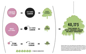
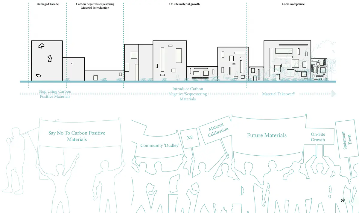
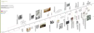
Localising Material Accessibility
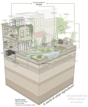
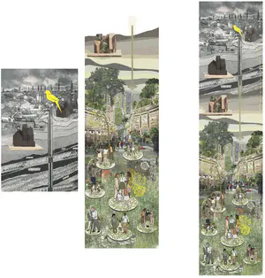
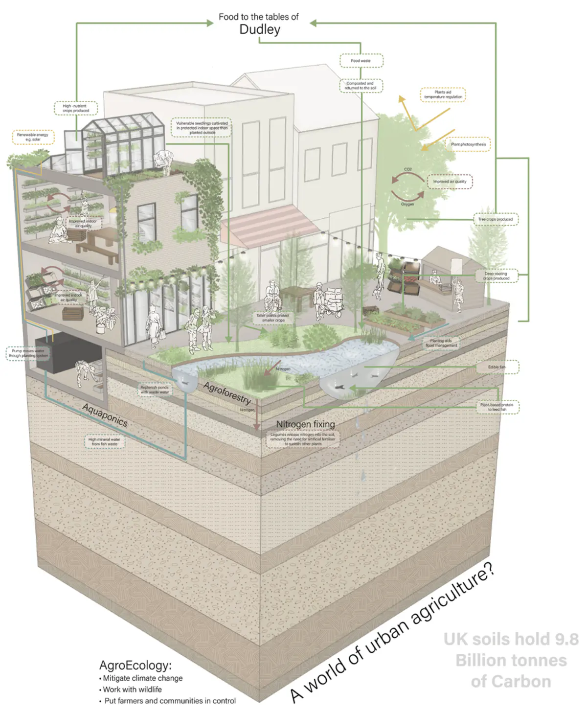
Community kitchen imagined story
Community kitchen imagined story