Dudley Time Portal
Wander
Archive
Random
About
Add
menu
Dudley Time Portal
close
wander
archive
random
about the project
add
Items tagged:
Map
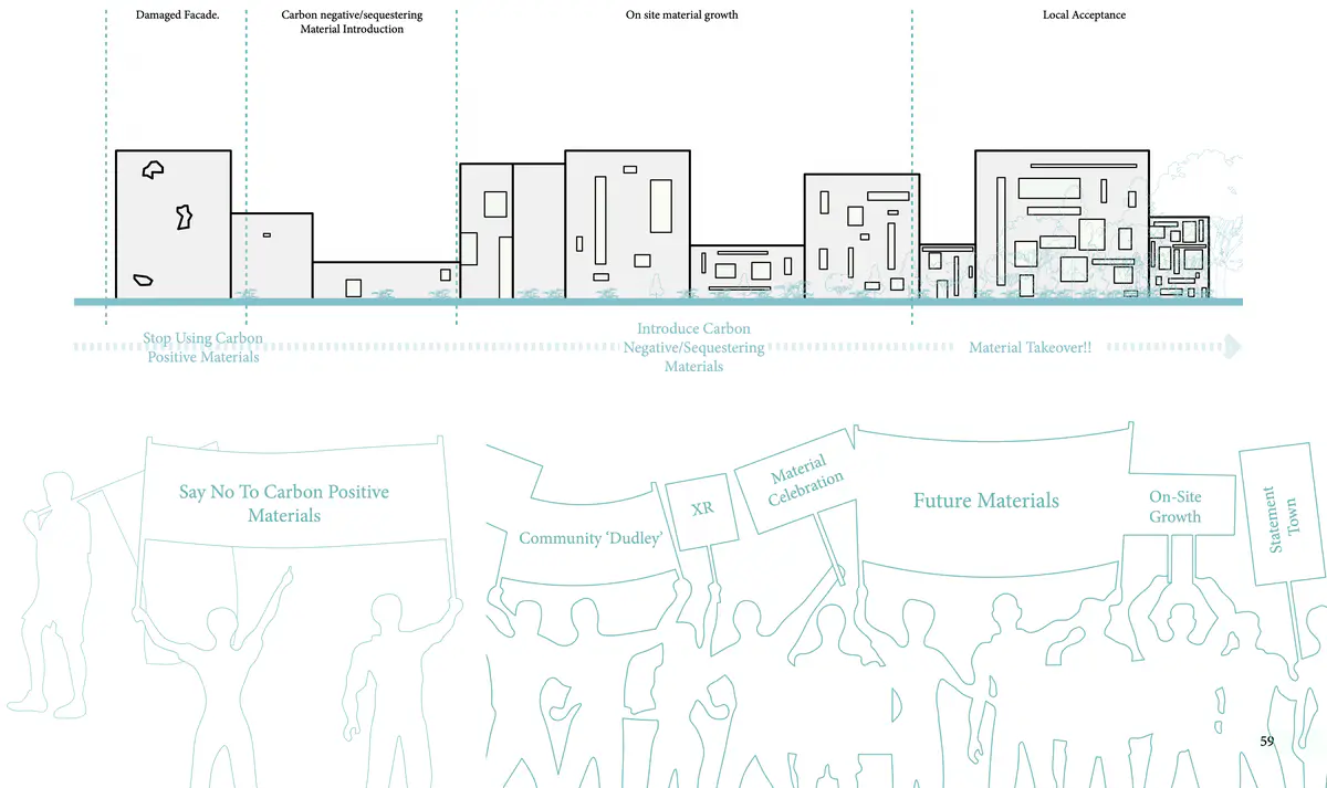
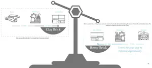
Localising Material Accessibility
Localising Material Accessibility
Diagram
Map
Aesthetic
Architecture
Biodiversity
Change
Climate
Community
Connection
Creatures
Decay
Doughnut
Future
Growing
Identity
Imagination
Industry
Material
Nature
Opportunity
Pollution
Potential
Regenerative
Sustainable
System
Transport
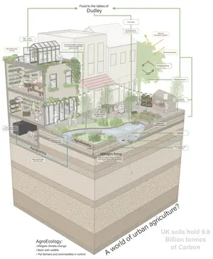
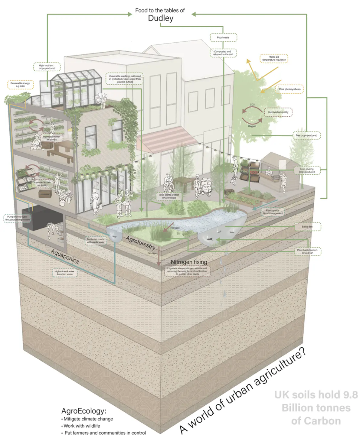
Nurturing AgroEcology in Urban Life
Nurturing AgroEcology in Urban Life
Drawing
Imagining
Map
Architecture
Biodiversity
Climate
Community
Connection
Consumption
Craft
Creativity
Creatures
Food
Growing
Imagination
Life
Making
Material
Nature
Opportunity
People
Plantlife
Pollution
Potential
Regenerative
Soil
Sustainable
System
Technology
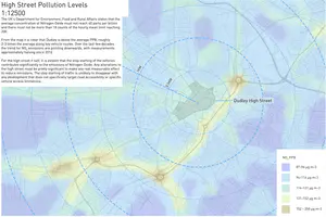
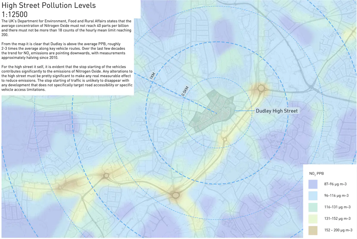
High Street Pollution Levels
High Street Pollution Levels
Diagram
Map
Pollution
Traffic
Vehicle
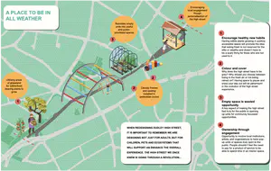
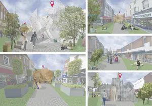
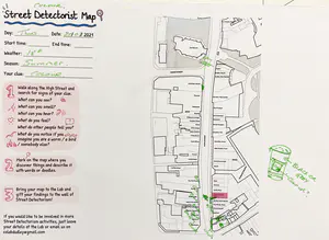
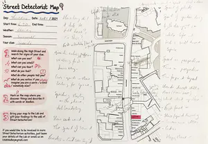
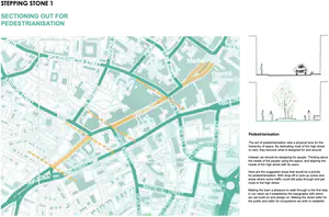
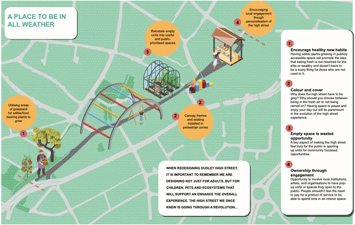
My Street 2030
My Street 2030
Drawing
Map
Access
Actions
Agency
Care
Change
Colour
Commerce
Community
Consumption
Curiosity
Economics
Emotion
Fairness
Food
Future
Growing
Health
Imagination
Interacting
Invitations
Layer
Life
Lingering
Nature
Opportunity
Ownership
People
Plantlife
Potential
Shelter
Stillness
Unused
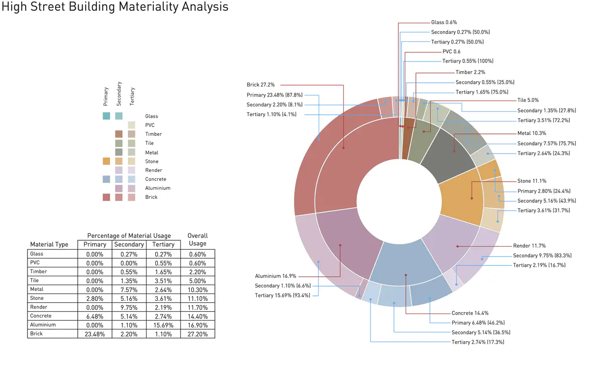
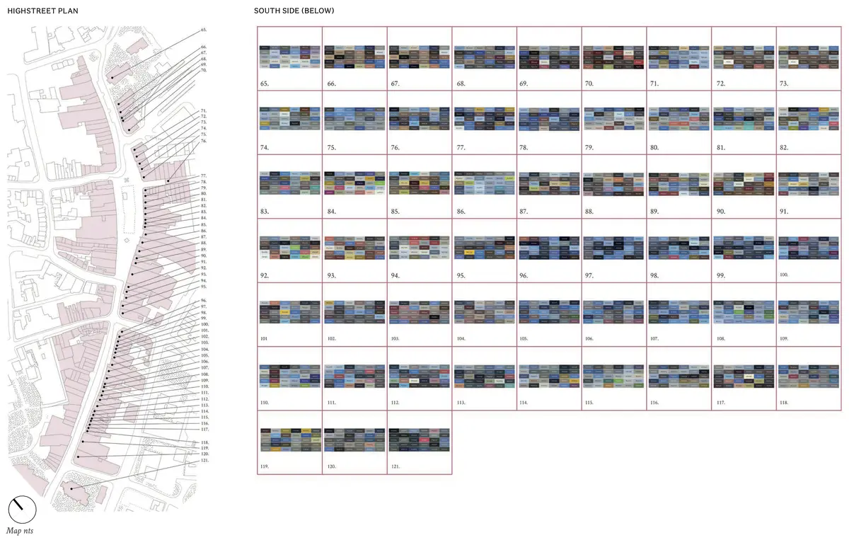
High Street building materiality analysis
High Street building materiality analysis
Diagram
Map
Architecture
Colour
Material
Water Collection
Water Collection
Count
Diagram
Map
Text
Growing
High
Material
Nature
Opportunity
Plantlife
Potential
Regenerative
Sustainable
System
Waste
Water
Green revolution concepts
Green revolution concepts
Collage
Drawing
Imagining
Map
Architecture
Change
Craft
Future
Growing
Identity
Imagination
Industry
Learning
Memory
Nature
Past
Plantlife
Potential
Shelter
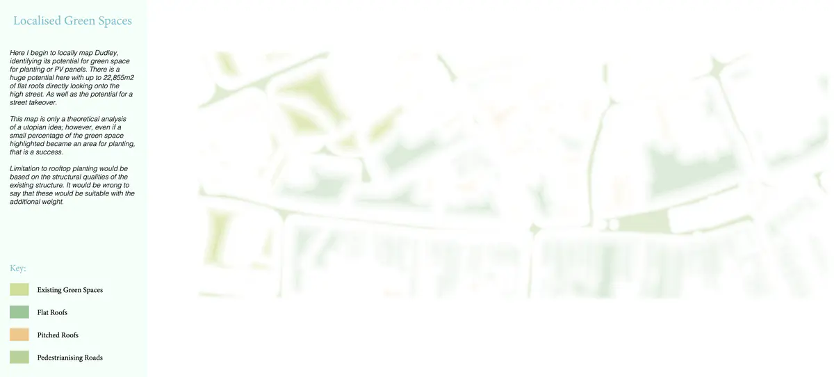
Localised Green Spaces
Localised Green Spaces
Diagram
Map
Growing
High
Nature
Opportunity
Plantlife
Potential
Regenerative
Sustainable
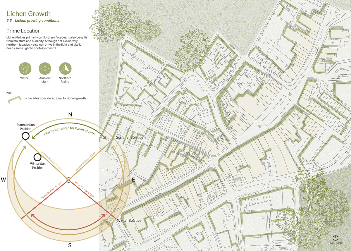
Lichen Growth
Lichen Growth
Map
Air
Architecture
Growing
Imagination
Life
Light
Nature
Plantlife
Water
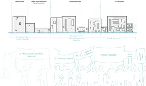
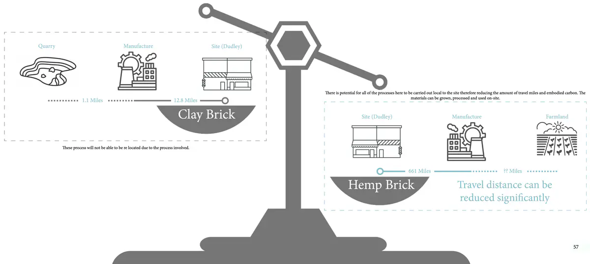
Material Accessibility
Material Accessibility
Diagram
Map
Change
Climate
Material
Opportunity
Potential
System
Transport
Industry 4.0
Industry 4.0
Collage
Drawing
Imagining
Map
Abundance
Actions
Agency
Architecture
Change
Community
Connection
Creativity
Difference
Doughnut
Economics
Future
Imagination
Industry
Interacting
Invitations
Learning
Making
Material
Opportunity
Ownership
People
Potential
Regenerative
Shelter
Technology
Unused
Bin - can hardly see the Dudley coat of arms (didn’t notice it before) - dripping ice-cream down the side.
Bin - can hardly see the Dudley coat of arms (didn’t notice it before) - dripping ice-cream down the side.
Drawing
Map
18C
Cloudy
Slight breeze
Colour
Identity
Waste
Material analysis
Material analysis
Diagram
Map
Photo
Architecture
Material
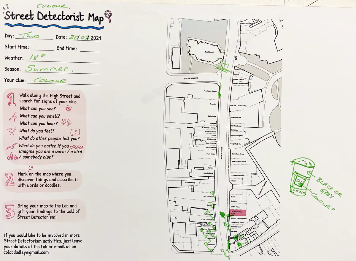
Shop fronts are mostly reds and blues
Shop fronts are mostly reds and blues
Map
18C
Cloudy
Slight breeze
Colour
Commerce
Identity
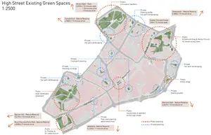
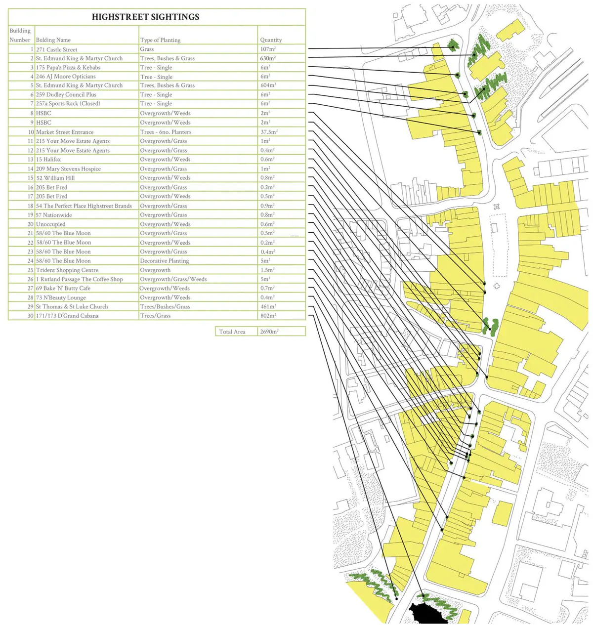
High Street existing green spaces
High Street existing green spaces
Diagram
Map
Growing
Nature
Plantlife
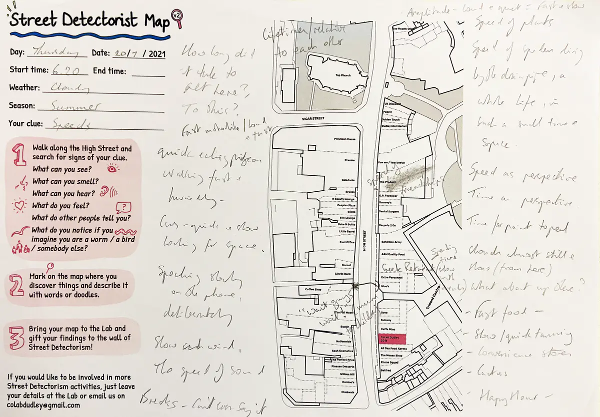
'Fast motorbike / loud & fast'
'Fast motorbike / loud & fast'
Map
18C
Cloudy
Slight breeze
Sounds
Speeds
Vehicle
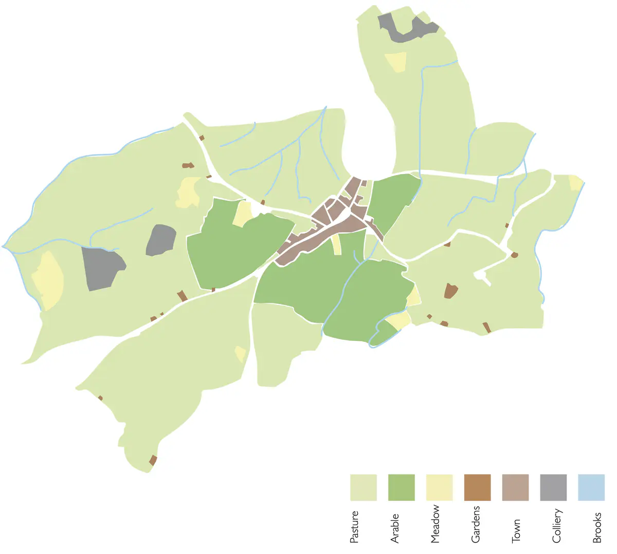
Township of Dudley 1750
Township of Dudley 1750
Map
Growing
Past
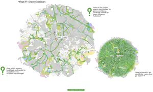
What if? Green corridors
What if? Green corridors
Map
Boundaries
Growing
Nature
Plantlife
Water
Lichenisation
Lichenisation
Collage
Diagram
Drawing
Imagining
Map
Air
Architecture
Community
Creatures
Growing
Imagination
Life
Light
Nature
Opportunity
Plantlife
Potential
Water
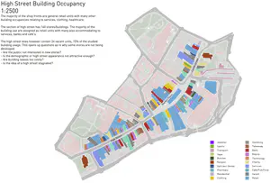
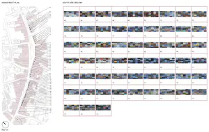
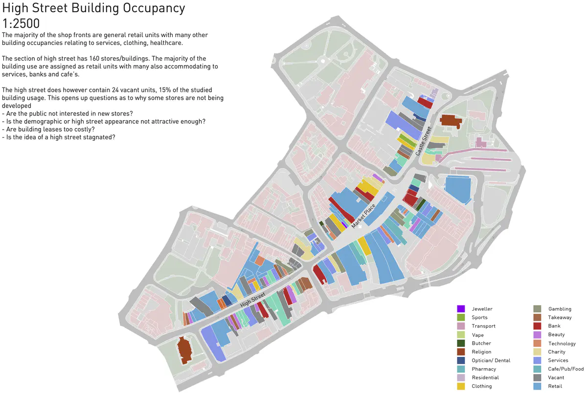
High Street Building Occupancy
High Street Building Occupancy
Diagram
Map
Commerce
Consumption
Unused
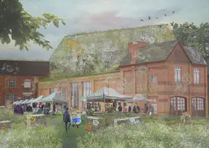
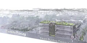
Dudley Food Hub
Dudley Food Hub
Diagram
Drawing
Map
Photo
Architecture
Biodiversity
Community
Creatures
Food
Growing
Health
Learning
Nature
Plantlife
Regenerative
Sustainable
System
Unused
Waste
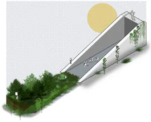
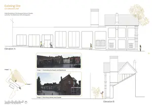
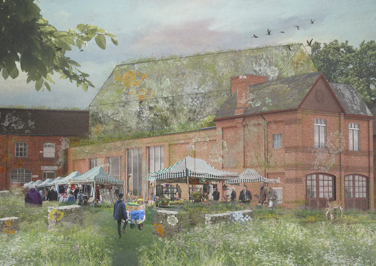
Glasshouse existing elevations
Glasshouse existing elevations
Drawing
Map
Photo
Architecture
'Walking fast & hurriedly'
'Walking fast & hurriedly'
Map
18C
Cloudy
Slight breeze
Actions
Speeds
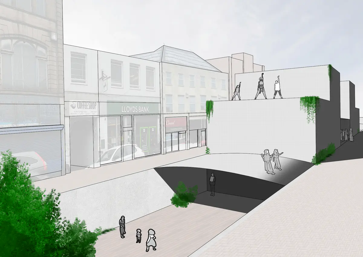
My Street 2030
My Street 2030
Drawing
Imagining
Map
Access
Change
Future
Imagination
Moving
Opportunity
People
Potential
Safety
Traffic
Transport
Vehicle
Nurturing AgroEcology in Urban Life
Nurturing AgroEcology in Urban Life
Drawing
Imagining
Map
Architecture
Biodiversity
Climate
Community
Connection
Consumption
Craft
Creativity
Creatures
Food
Growing
Imagination
Life
Making
Material
Nature
Opportunity
People
Plantlife
Pollution
Potential
Regenerative
Soil
Sustainable
System
Technology
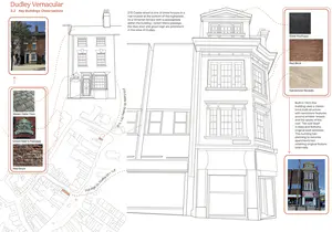
Dudley Vernacular
Dudley Vernacular
Drawing
Map
Photo
Architecture
Material
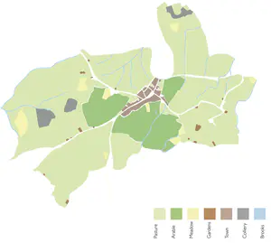
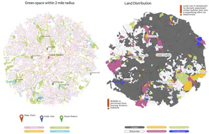
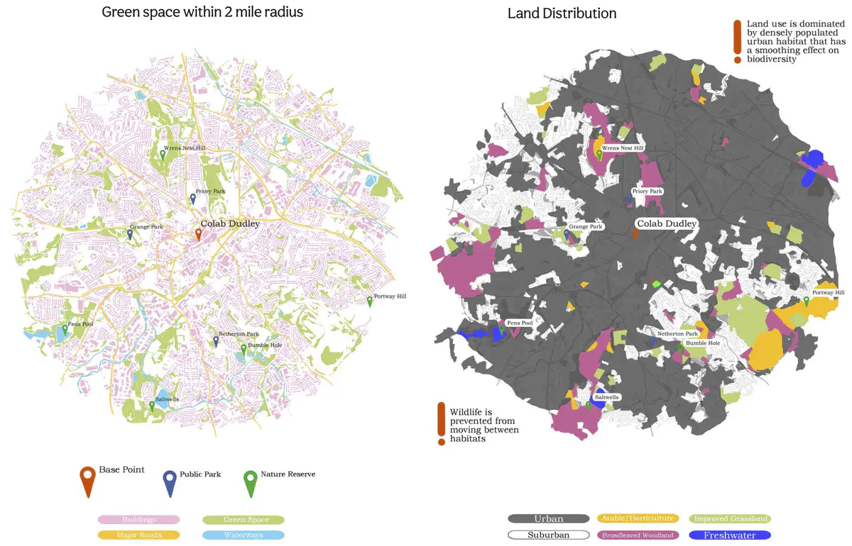
Green space / land distribution
Green space / land distribution
Map
Architecture
Boundaries
Growing
Nature
Plantlife
Water
It’s difficult to see green from plants although then noticed the weeds in the pavement and buildings
It’s difficult to see green from plants although then noticed the weeds in the pavement and buildings
Map
18C
Cloudy
Slight breeze
Colour
Growing
Hiding
Nature
Plantlife
Surprise
'Quick eating pigeon'
'Quick eating pigeon'
Map
18C
Cloudy
Slight breeze
Actions
Creatures
Food
Nature
Speeds
Green revolution
Green revolution
Collage
Drawing
Imagining
Map
Architecture
Change
Craft
Future
Growing
Identity
Imagination
Industry
Learning
Memory
Nature
Past
Plantlife
Potential
Shelter
High street facade colour palette
High street facade colour palette
Diagram
Map
Photo
Architecture
Colour
Street plant sightings
Street plant sightings
Map
Photo
Care
Growing
Nature
Plantlife
Pollution
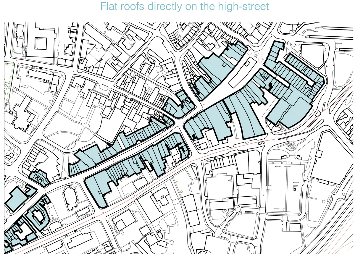
High Street Voids
High Street Voids
Collage
Diagram
Drawing
Imagining
Map
Photo
Text
Aesthetic
Archaeology
Architecture
Biodiversity
Change
Climate
Community
Decay
Energy
Growing
Health
Imagination
Learning
Nature
Opportunity
Past
Plantlife
Potential
Regenerative
Sustainable
Unused
Water